


Land North of The Bourne Public Consultation
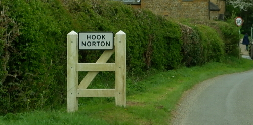
The initial consultation is now closed - thank you for your feedback.
Welcome to the public consultation for the development of the land
north of The Bourne, Hook Norton.
This interactive website will guide you through the proposals and at
the end ask you to complete a brief survey.
info Look out for bronze highlighted text like this - it will indicate interactive features on the map.
We are still in the design phase, and the thoughts of local
residents will help us shape the final proposals. The sections below
set out our ideas, and your views on this are very important to us.
This consultation closed on 23rd October 2022. We will
now use the feedback provided in this consultation to influence
future design decisions.
touch_app Scroll to read more
info Zoom in and pan the map to see some of the nearby local facilities.
Map Key
| Site Boundary |
The site, local heritage & village character
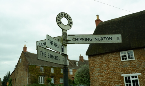
The site is on the northwest edge of Hook Norton. This is about 10
km southwest of Banbury and 6.5 km northeast of Chipping Norton.
Hook Norton has a long history and distinctive character, reflected
within the Hook Norton Conservation Area. We want our plans to work
with this character to ensure the proposed homes blend into the
village.
We aim to complement the village setting and character by ensuring
there are open spaces alongside homes.
Map Key
| Site Boundary | |
| Hook Norton Conservation Area |
Our Vision
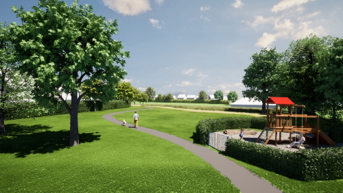
Our vision is to create a high-quality, energy-efficient, and modern
development. This will fit naturally into the green and historic
character of Hook Norton.
The development will arc around the existing Sports and Social Club
on the edge of the village.
A swathe of open space will create new areas for play and
recreation. These will link into a connected network of tree-lined
streets and ecological corridors.
info Click on the map markers to find out more about our vision and to view illustrative images of our proposals.
A community green at the corner of The Bourne and Clay Bank will
form a new Green Junction. This will retain views to and from
existing properties.
The proposals allow for the development of up to 75 new homes of
mixed type, tenure, and size. Of these homes, 35% would be
Affordable Housing. For example, homes for social or affordable
rent, starter homes, and shared ownership homes.
The most southern homes will be limited in height to respect the
character of existing bungalows along The Bourne. This is in
response to existing variation in building height.
Map Key
| Design Information | |
| Illustrative images of the site |
Landscaping and green spaces
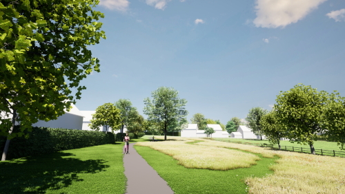
We have prepared our designs using a landscape-led approach that
balances new residents' needs with those of nature.
All existing trees and hedgerows will be retained within open areas,
except for small gaps required for access. New tree planting will
soften the borders shared with the wider countryside.
info Click on the map markers to find out more about our proposed landscaping.
New views from the highest point on the site to St. Peter's C of E
Church and the village centre will be opened up and celebrated.
There will be a public green space in the centre, with new play
facilities for future and existing residents.
The landscaping on the site will use surface water drainage features
such as:
- rain gardens
- swales
- porous paving
- attenuation basins
These will improve the availability of habitats and increase biodiversity.
Map Key
| Green Landscaping | |
| Sustainable Drainage | |
| Public Spaces |
Access and connectivity
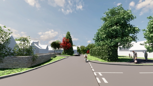
The vehicle entrance to the site will use the existing access to the
Hook Norton Surgery car park off The Bourne. Current access to the
surgery will remain.
A new pedestrian connection in the southwest corner will connect
with the vehicle access. This will run on the north side of the
existing hedgerow.
This will provide safe, direct pedestrian links with Clay Bank and
the rest of the village to the south. In addition, it will complete
a missing link in the existing walking network. This will improve
connectivity for the wider community.
info Click on the map markers to find out more about access to the site and zoom in to explore the connections to nearby facilities.
The site is well-connected to existing facilities as shown with the average walking times:
- 5 minute walk to nearest bus stop
- 9 minute walk to the Hooky Hub
- 10 minute walk to the SPAR
- 12.5 minute walk to the primary school
The street design will draw on the typical characteristics of the village. Irregular, wide grass verges allow space for new tree planting along the primary loop. Courtyard groups will reflect the agricultural history of the village.
Map Key
| Site Access Information | |
| Average walk times to nearby facilities from centre of the site |
Your Thoughts

The initial consultation is now closed - but comments and suggestions are still welcome.
Thank you for reading about our proposals for the land north of The
Bourne, Hook Norton.
Please complete the brief survey below. Your views really matter to
us.
question_answer Answer the survey here
The survey will close on 23rd October 2022.
Once you have completed this survey, we will look carefully at all
of the feedback. We will then prepare our final design details ahead
of a formal planning application.
info Click on the map marker to go to the survey, or click on the bronze button above.
Map Key
| Link to the Survey |
Brought to you by:

An
Engaged Space community engagement on behalf of L&Q Estates.
Powered by
Deetu.
Got a story to tell?
Get in touch.

touch_app Back to the start
