

Perrysfield View Public Consultation

This consultation is now closed, but comments and suggestions are still welcome.
Welcome to the public consultation for the development of
Perrysfield View, near Oxted.
This interactive website will guide you through the proposals
and ask you to complete a short survey.
info Look out for green highlighted text like this - it will indicate interactive features on the map - and scroll this menu to read more.
We are in the design phase, and the thoughts of local residents will help
us shape the final proposals. The sections below set out our ideas, and
your views on this are very important to us.
This consultation will close on 21st December 2022. We will use the
feedback provided to influence future design decisions.
touch_app Scroll to read more
Map Key
| Site boundary | |
| Railway line |
Site Context

The site about 1.3 miles southwest of Oxted town centre, on the
corner of Gibbs Brook Lane and Southlands Lane.
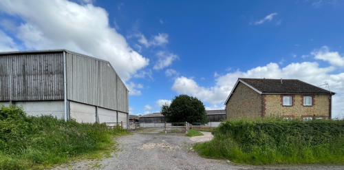
Currently, the site consists of underutilised farmyard buildings
at the end of their commercial life. The landowner is focusing
their farming operations at their larger, more modern sites,
primarily Newhouse Farm. This will help reduce the number of
farm vehicles travelling on the local roads.
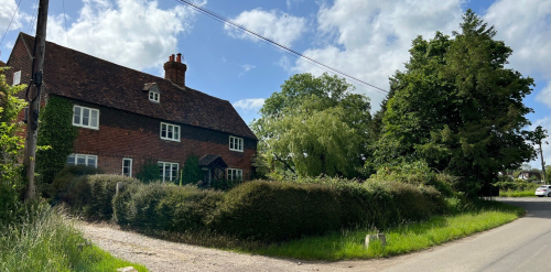
info Click on the map markers to see streetview photos of the current site perimeter.
The landowner has asked us to prepare a vision for the next chapter
of life for this land.
We will remove the farmyard buildings, but retain the farmhouse and
the horse engine barn. Alongside the rest of the land, these will be
repurposed to benefit the local, rural community.
The following sections explain our vision in more detail.
Map Key
| Site boundary | |
| Streetview photos of current site |
Which buildings will stay?

The existing farm sheds are big and bulky in the landscape. We are proposing to replace these with smaller buildings, reducing the built footprint by about half. These new buildings will be in-keeping with the agricultural character of the land. They will be of a higher quality than the existing buildings and more sustainable.
info Click on the map markers to find out more about the proposed layout of the new buildings.
The buildings will be set back from the edge of Southlands Lane
and away from the retained heritage buildings. They will focus
around the centre of the site, with smaller homes around the
edges.
Map Key
| Site boundary | |
| Information about the proposed layout | |
| Existing buildings to be removed | |
| Proposed new buildings | |
| Existing buildings to be retained |
Our Vision

Our vision for this site is to create a truly special place to live. A community living in a mix of homes, taking advantage of the outstanding setting. We have a chance to improve this rural area and reduce the amount of development.
info Click on the map markers to read more about our vision for the site.
The site is located within the Green Belt and local Conservation
Area. We are proposing a low-density development which maintains
this agricultural and rural character. The height of the new
homes will not exceed that of the existing barns.
Our plans will increase the openness of the site, whilst creating
a new biodiverse landscape. The houses will be fit for the future
and adaptable as the needs of residents change. They will be
carefully designed to use little energy.
Map Key
| Information about our proposed vision |
Sustainable Homes for Rural Living

If you live rurally, and you cannot find a new home, you could be forced to
move many miles away. Unfortunately, this is a common problem in many rural
areas.
Our plans would help to address this problem by providing much-needed
new homes in a rural setting. A mix of house types will cater for a
variety of residents. Those looking for more space for their family,
or those looking to downsize.
info Click on the map markers to read more about the environmentally-friendly and sustainable design of the new homes.
There will be a variety of house types:
- Affordable homes (for example, shared ownership schemes or affordable rent)
- Family homes
- Age-restricted housing (over 55s)
- Re-use and refurbishment of heritage buildings
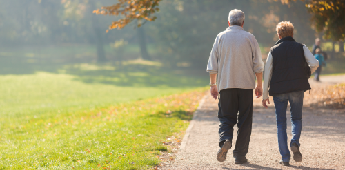
There is an identified shortage of homes ideal for those later
in life. We are looking to deliver some age-restricted housing,
which will promote independent living. These homes would be
adaptable and designed to suit many needs. They would be ideal
for those looking to downsize and stay in the area, as their
primary residence.
We will also improve the setting of the heritage buildings. The
locally listed barn next to the farmhouse will be refurbished for
residential use.
Map Key
| Information about the new homes |
Landscaping

A key part of the vision is to keep the rural agricultural character of the land. We propose a new biodiverse landscape with sustainable drainage, such as rain gardens amongst the new houses.
info Click on the map markers to read more about our landscaping proposals.
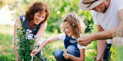
Residents will have access to the extensive open space. This
will include wildflower meadows, an orchard, wildlife pond,
and potential community growing areas. Residents of any age
will be able to enjoy and be active in these spaces.
We will enhance the biodiversity, with extensive new hedgerows
and trees. We will also encourage wildlife in other places, for
example with bat and barn owl boxes.
Map Key
| Information about the proposed landscaping | |
| Illustrative photos of proposed landscaping |
Travel & Connectivity

Homes will be low energy in use and promote low energy living. Every new house will have a private electric vehicle (EV) charging point and ample cycle storage. There will be space for visitors to charge their cars and park their bikes.
info Click on the map markers to see more about the proposed travel infrastructure.
We propose an extra stop on the existing bus route to further
promote sustainable living. Residents will be able to get to
the new bus stop via a dedicated footpath and wait off the road.
There will be one vehicular access point from Gibbs Brook Lane.
This is in the same place as the current access to the farm
sheds. We will reduce the new access to reflect the smaller
number of vehicles using the road.
Map Key
| Information about proposed transport infrastructure | |
| Illustrative photo of proposed bus stop |
Your Thoughts

This consultation is now closed, but comments and suggestions are still welcome.
Thank you for reading more about our proposals for Perrysfield
View, near Oxted.
Please complete the brief survey below. Your views really matter
to us.
question_answer Answer the survey here
The survey will close on the 21st December 2022.
Once you have completed this survey, we will look carefully at
all the feedback. We will prepare our final design details
before submitting a formal planning application in the new year.
info Click on the map marker to go to the survey, or click the green button above.
Map Key
| Site boundary | |
| Go to the survey |
Brought to you by:
Knightwood Developments Ltd
An
Engaged Space community engagement on behalf of Knightwood Developments Ltd.
Powered by
Deetu.
Got a story to tell?
Get in touch.

touch_app Back to the start
